Walk a Riverton Street Record by Record
A whole-street search works best as a chain, not a single name query. Start with one full address and preserve its directional, street type, unit, and postal city. Riverton’s numeric South and West grid makes small formatting changes matter. A parcel ID then becomes the bridge between the Assessor, GIS, Recorder, and permit systems.
- Enter the address in the Salt Lake County Assessor Find a Parcel form and save the parcel ID, owner, situs, mailing address, and tax information.
- Open the Assessor GIS viewer, click the surrounding parcels, and note the IDs that share the street segment.
- Use the Utah voter lookup or a lawful data route for registered-voter information, remembering that protected records are withheld.
- Search the Recorder list by address or parcel, read the recording dates and legal descriptions, then request an image through the correct channel.
- For past households, consult the University of Utah suburban directory shelf and compare adjacent editions.
The chain is address → parcel → owner → recorded documents → permitted work → historical household. It can support careful research about property and past presence, but it does not produce a list of every person in a home.
Riverton’s Assessor Fields Matter
The current Assessor form offers Owner, Address, and Parcel Number modes. The legacy query is useful when a clean address fails or a researcher has only part of a parcel number. It exposes frontage, direction, street name or number, street type, and a trailing direction. The full parcel pattern is 00-00-000-000-0000. The first seven digits can find a block, while the first ten digits narrow a parcel before the final encumbrance digits.
| Field | Entry and use |
|---|---|
| Owner name | Last Name, First Name; the legacy screen asks for at least three letters. |
| Address | Type until the autocomplete list offers the exact address. |
| Frontage and direction | House number plus S or W where the grid requires it. |
| Street name or number | Combine with type and trailing direction for a narrow hit. |
| Parcel number | Use the full ID or a documented prefix to search a block. |
The record may include owner, property location, mailing address, parcel ID, assessed and market information, exemptions, tax district, sketch, and detail links. A tax mailing address can differ from the situs. It is a clue about where correspondence goes, not proof of the owner’s residence or the identity of every occupant.
- Parcel
- A numbered land and assessment unit.
- Situs address
- The physical location of the property.
- Plat
- A recorded map that lays out lots, blocks, and roads.
- Criss-cross directory
- An address-order directory that lets a researcher move from a street to a name.
Browse Riverton Parcels in GIS
The county GIS viewer turns a street search into a visual pass. Locate the first address, click its parcel, then move across the adjacent lots. The map can expose boundaries, tax districts, aerial context, and other layers available in the current viewer. Parcel details link back toward Assessor information. Layer dates vary, so a map should be treated as a current research aid rather than a permanent survey.
Road centerlines and parcel edges are not the same thing. A common area, a split lot, a rear parcel, or a recorded legal description may not look like the mailing address suggests. Write down the parcel ID for every adjacent lot before opening owner records. If the goal is a whole block, the Riverton neighbors lookup uses this same method at a smaller radius.
The county’s official GIS page explains the parcel viewer and its map-layer route.

What Riverton Records Show by Street
Several record sets are keyed to an address, but each describes a different event or relationship. The table keeps those roles distinct.
| Record set | Keeper | Street-level evidence | Access |
|---|---|---|---|
| Assessor parcel | Salt Lake County Assessor | Owner, situs, mailing address, ID, values, exemptions | Free search |
| GIS parcel | Assessor GIS | Boundaries, aerials, tax districts, layers | Public viewer |
| Deed, mortgage, lien, plat | County Recorder | Grantor, grantee, dates, legal description | Free list; images may cost |
| Voter record | County and Utah Elections | Public fields for non-protected voters | Rules and At-Risk status apply |
| Permit record | City or county | Work, project, owner or applicant clues | Request route varies |
Recorded rows can show document number, recording date, type, current owner, legal description, and parcel or address context. The free list is informational and may be at least 24 hours old. Images are a separate step. Paid Recorder access includes a $5 temporary 24-hour option for 150 data units and larger packages, while plats have their own charges. Verify the current schedule before ordering.
Read the Deed Chain Along Riverton Streets
The Recorder’s free public search begins with terms acknowledgement, then asks for an address or parcel chosen from an autocomplete field. If an address fails, use the parcel, legal description, subdivision, lot, or block. Read the newest document first. A warranty deed may be followed by a plat, amendment, mortgage, release, or lien. A deed chain is a sequence of recorded transfers, not a resident list.
For a street-by-street pass, record the parcel ID and legal description for each lot, then compare recording dates. A grantor is the party transferring an interest. A grantee receives it. A legal description identifies the land in words or by recorded plat, so it can remain useful when an old farm parcel predates a modern street number. The county says images are normally available the next working day when recorded before 2 p.m., but the live office controls the current timing.
County Archives bridges gaps. Land-title certificates cover 1851–1895, mortgages cover 1888–1951, and historic deeds and plats may require an archive or office request. The Recorder does not state one online index start year, so do not invent a cutoff.
Riverton Permits Add an Address Trail
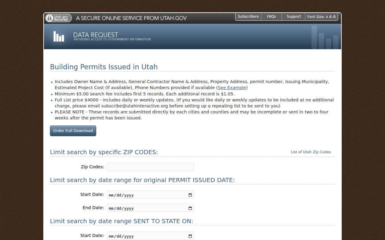
Permits can show an applicant, owner, architect, contractor, project, cost, legal description, inspection, or occupancy clue. They document an action, not a census. The State building-permit request accepts ZIP and issued or sent-date filters, charges $5 for the first five records and $1.05 for each additional record, and warns that city or county data may be delayed two to four weeks or incomplete.
County Archives holds building-permit application cards from 1948–1969 and later permits approximately 1970–2019. Incorporated-city files may remain with Riverton. Because the city’s permit report returned a 403 during research, ask the city or county which custodian has the address file. Include the street, parcel, date range, and project type in a GRAMA request rather than asking for “everyone who lived there.”
Old Riverton Streets Need Old Sources
The University of Utah collection lists a 1974 Salt Lake City Suburban directory that includes Riverton, with listings for 1975, 1976, 1977–78, 1979, 1980, and later runs. Its street or criss-cross section can turn a historic address into an occupant name. Exact scans, page numbers, publishers, and a complete annual run require item-level checking. The volume is a regional directory, not a complete Riverton census.
County appraisal cards and photographs are another address-keyed source. The descriptive range is 1934–1987, with bulk material from 1936 through the 1970s, while a heading says 1970s–1991. Keep that discrepancy visible. Cards can preserve rooms, additions, year built, depreciation, and footprint. A historic-building search returned 291 Riverton records, including Redwood Road properties. The Directory Book page handles the collection reading method; this street directory uses it only as a past-household tool.
When Riverton Street Names Shift
Preserve numeric South and West elements, leading zeros when printed, street type, unit, ZIP, and historical city label. USPS ZIP 84065 is the ordinary Riverton label, yet DMM L012 lists 84096 with the last line “RIVERTON UT 84065.” The 2006 Postal Bulletin records a 6,116-delivery shift. A postal string and a legal municipality therefore may not line up.
A state-certified 2018 Riverton and Bluffdale boundary plat is the correct place to check that municipal question; the research says no privately held parcels transferred. Do not change an old address to make it look modern. Search the original form, then test the current parcel and boundary records.
Note: Keep the postal, municipal, and property-record dates together when a Riverton address appears to change.
Where a Riverton Street Directory Stops
A street directory can show owners, filed parties, public voter fields, permits, and historical entries. It does not reveal every household member. Renters, guests, children, utility customers, and delivery recipients are not a public roll. Utah DMV records are restricted by the Driver’s Privacy Protection Act and Utah law. A missing name does not prove that no one lives at an address.
Utah GRAMA requests can seek existing, identifiable city or county records, subject to classification, actual-cost fees, and redaction. Stop at a protected Safe at Home address, At-Risk voter record, or uncertain same-name match. When the goal shifts from a whole street to one person, use the Riverton resident lookup workflow and compare independent fields.
Riverton Street Portal Access
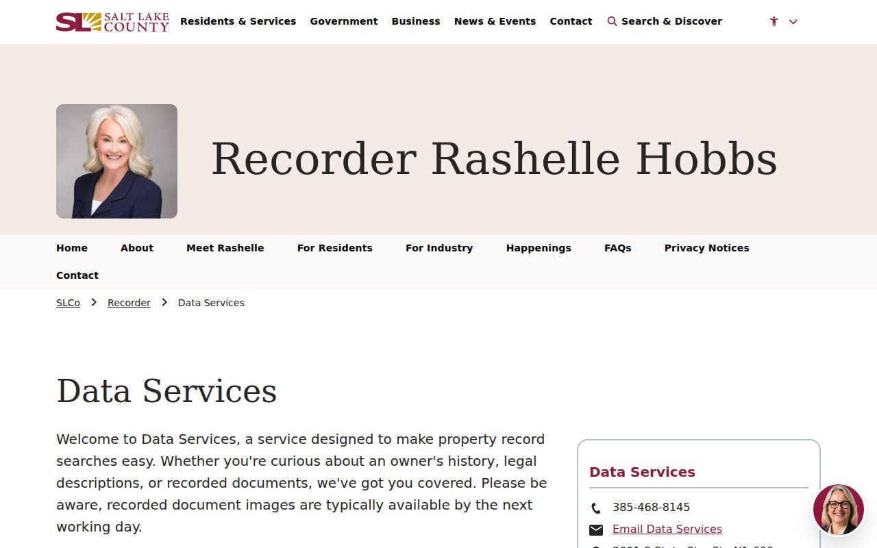
The county offers more than one property screen. The free Recorder list is useful for a first pass, while Data Services describes temporary and larger paid packages. The Assessor page is the owner and parcel entry point. The legacy query helps when a directional, frontage, or partial parcel is the only usable clue.
See the Recorder Data Services explanation for access and image timing.
The Assessor property screen shows the current parcel search modes.

The Property Watch page illustrates address, parcel, document, and date alert fields.
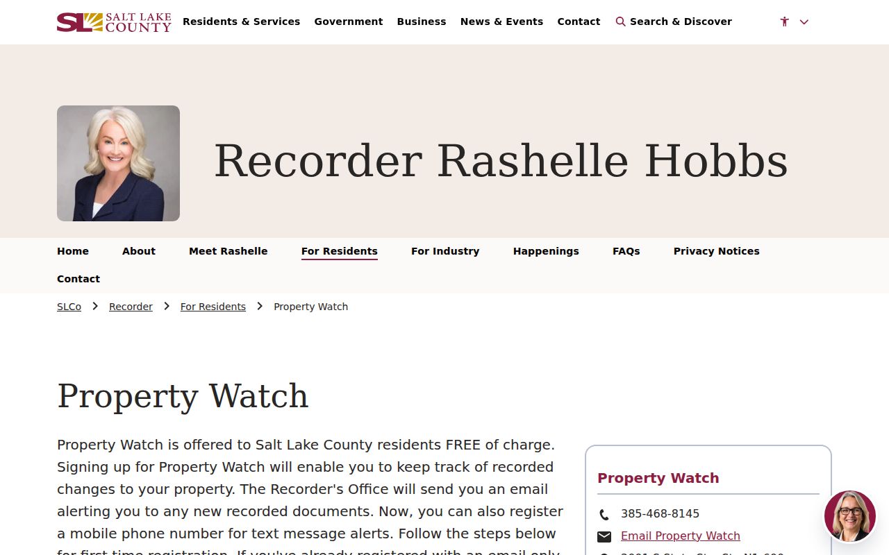
The detailed legacy assessor query provides extra street and parcel fields.
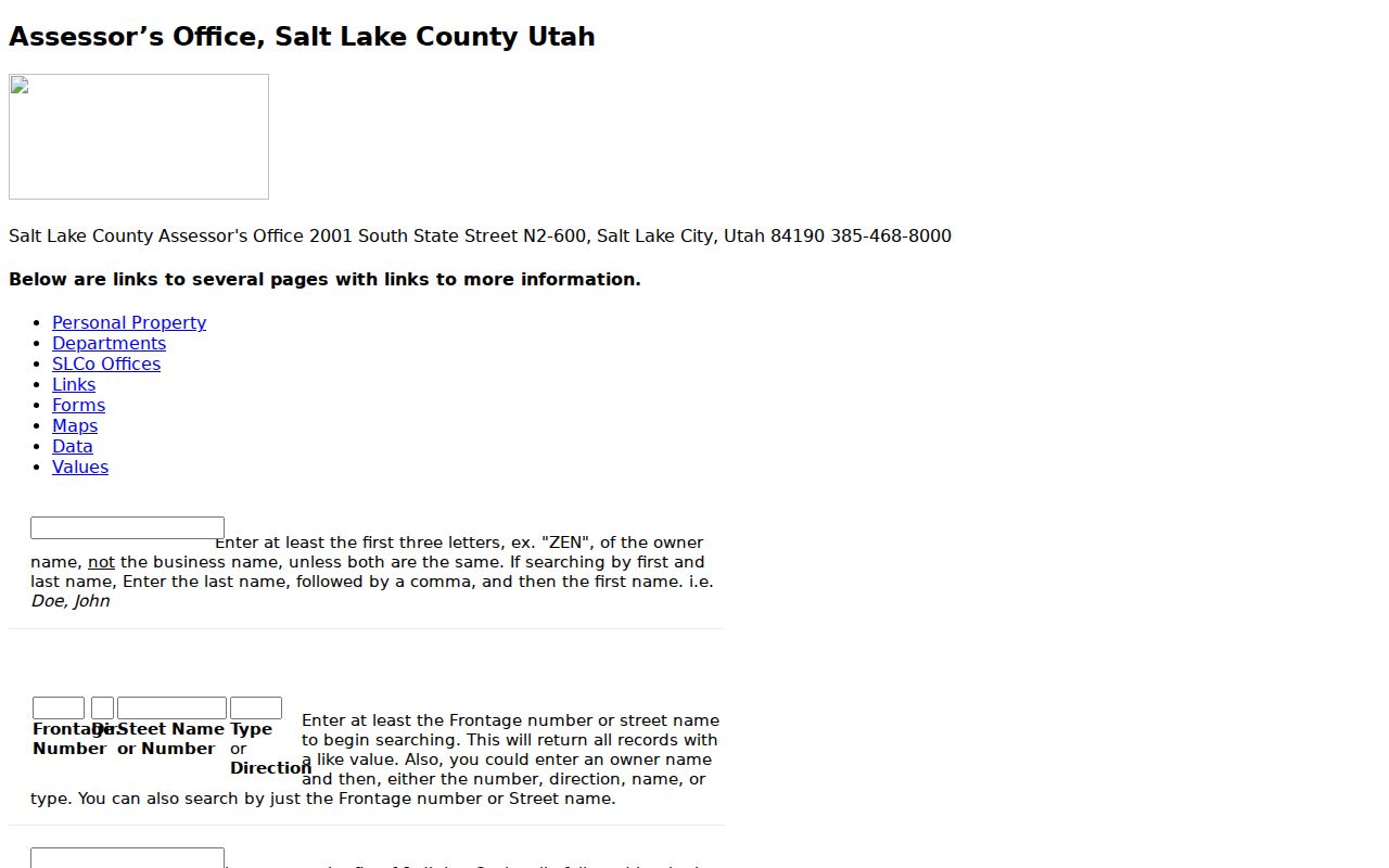
State building-permit data is another address clue. Its ZIP and date request should be checked against the originating city or county office.